Current Forecast 2020-10-19 18Z
Forecast valid 2020-10-19 19:05:35.
Explanation
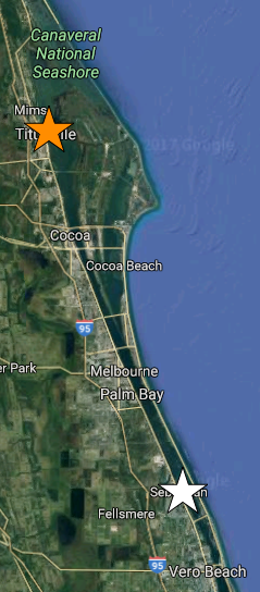
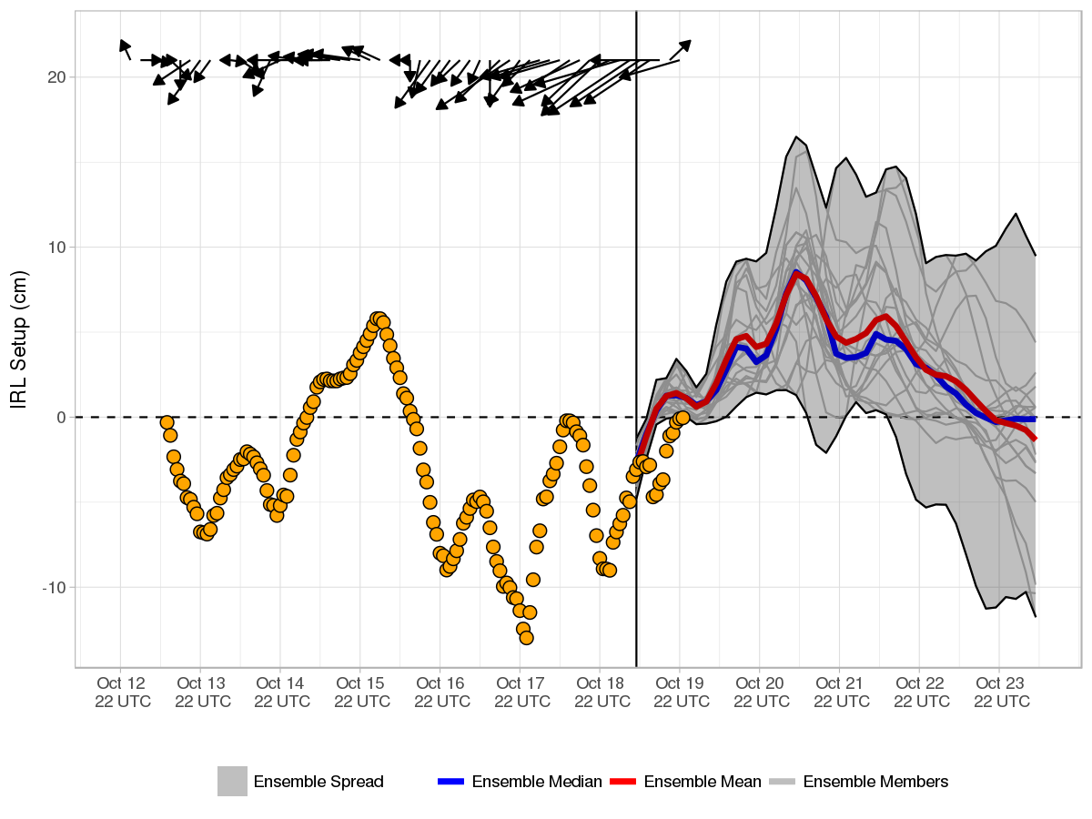
The above image shows the ensemble forecast of Indian River Lagoon (IRL) setup, defined as the difference in water elevation between Titusville, FL (orange star), and Sebastian, FL (white star). In general, southerly (northerly) winds result in increased water elevation near Titusville (Sebastian) and positive (negative) setup.
The current (18 UTC 2020-10-19) 0.5° Global Ensemble Forecast System (GEFS) mean and median forecasts of setup are represented by the red and blue curves, respectively. Ensemble spread from the current and three previous GEFS runs are shaded grey and bounded by solid and dashed curves, respectively.
Because real time observations of IRL setup do not exist, for verification purposes hourly estimates are provided (orange points) using wind observations from Orlando Melbourne International Airport (KMLB) following Colvin et al. (2017).
Additional Research
Real time coastal wind, wave, and water level guidance for the IRL is provided by the Florida Tech ADCIRC Storm Guidance System (FIT-ASGS).
Reference
Colvin, J, S. Lazarus, M. Splitt, R. Weaver, and P. Taeb, 2017: In preparation.